
Outdoor lighting audits · Asset intelligence
We measure outdoor lighting at network scale, then turn the data into clear maps for practical decisions.
Live field survey
Traffic-speed data collection
Kilometres surveyed
Lights audited
Road sections
System first developed
01 / Our approach
Outdoor lighting is too important to manage on assumptions alone.
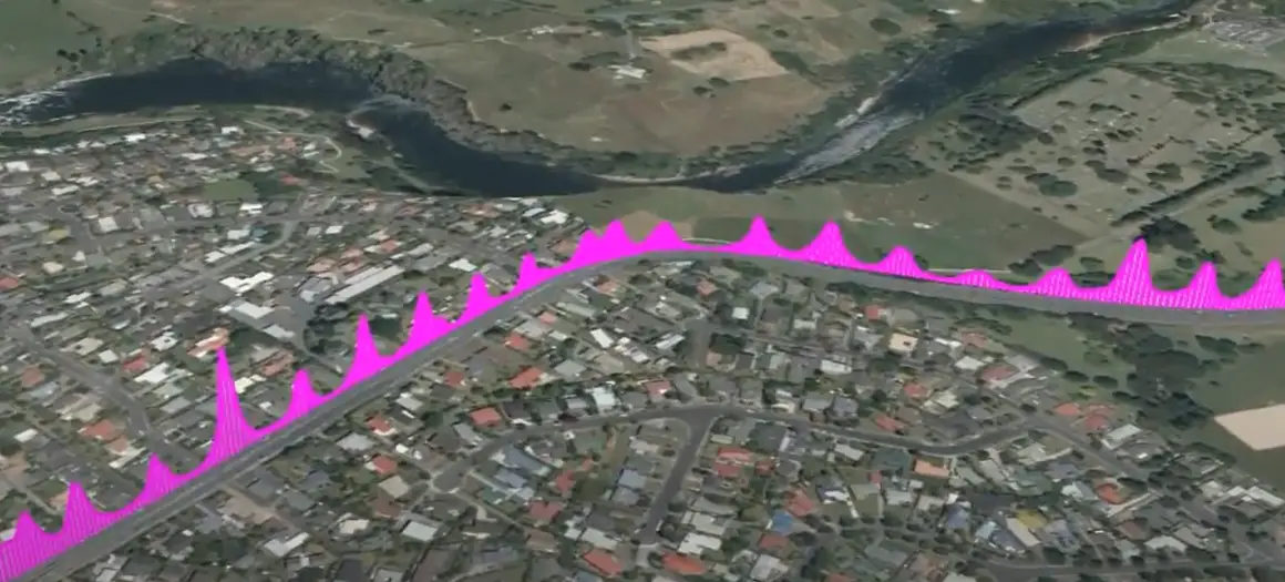
Lux Mapping captures repeatable measurements at traffic speed, connects every reading to an accurate location, and presents the result in formats your team can use.
01
Collect accurate lux and GPS data without road closures.
02
Apply lighting categories and assess performance at scale.
03
Deliver clear maps, reports and GIS-ready information.
Global licensees
We partner with technically capable organisations around the world that share our commitment to practical, high-quality lighting intelligence. Licensees gain access to the Lux Mapping system, training and ongoing support, so they can deliver proven outdoor lighting surveys and asset data to councils, road authorities and asset owners in their own country, backed by more than a decade of field experience.
A licence includes
—
Access to the Lux Mapping System
—
Technical and operational training
—
Ongoing technical support
—
Marketing material and guidance
We look for
—
Strong technical capability
—
Local market presence
—
Commitment to quality
—
Capacity to develop a territory
Income streams
—
Benchmarking Lux Surveys
—
Lighting Design
—
Pre & Post Lighting Upgrade Surveys
—
Maintenance & Cleaning Surveys
—
Airport Surveys
—
Toll Road Surveys
—
Pedestrian Area Surveys
—
Skyglow® Mapping Surveys
01
02
03
04
05
Find a local partner
Contact the partner for your region to arrange a lighting audit.
Our partners
02 / Selected applications
Different environments. The same goal: reveal the information that lets asset owners act with confidence.
01
Road networks
Verified Category P3 performance and established a repeatable baseline for the next review.
05
Council assets
Brought low-light roads and elevated crash risk into one clear prioritisation view.
08
Airports
Mapped illumination across aircraft stands to support targeted maintenance and safer operation.
03 / Services
Services can be scoped for one site, a project corridor or an entire network.
Built on experience
20+
years of practical electrical engineering experience held by each director
Partners & affiliations
Austraffic · Australia
C2SmartLight · Northern Europe
ISE-Energy · Gulf region
AITPM · Member
04 / Common questions
Answers to the questions asset owners ask most about Lux Mapping surveys.
01
Method
A Lux Mapping survey measures outdoor lighting from a vehicle travelling at normal traffic speed. Sensors record lux levels and each reading is linked to an accurate GPS location. The data is processed against lighting categories and delivered as maps, reports and GIS-ready files.
02
Method
The survey vehicle travels with normal traffic at night, so there is no need for lane closures, traffic management or staff working on the road. This makes it practical to survey a single corridor or an entire road network.
03
Standards
Results are compared with the lighting category that applies to each road, for example the AS/NZS 1158 categories used in New Zealand and Australia. This shows where lighting meets the required level and where it falls short.
04
Outputs
You receive clear maps that show lighting performance across the surveyed area, a summary report and GIS-ready data for your asset management system. The results help you prioritise upgrades, maintenance and cleaning.
05
Clients
Councils, road controlling authorities, airports, toll road operators and private asset owners use Lux Mapping surveys to benchmark lighting, check LED upgrades, plan maintenance and manage safety risk.
06
Coverage
Lux Mapping is based in Hamilton, New Zealand, and works with licensed partners in Australia, Singapore, Northern Europe and the Gulf region. Contact the partner for your region, or Lux Mapping for New Zealand and global enquiries.
Start a conversation