
 18 Mar 2020
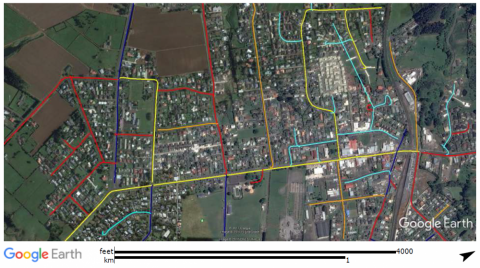
Task: Mobile data collection and mapping. Lux Mapping survey of local and collector type roads.
Presentation: Colour coded prioritization map in Google Earth format.
Outcome: Quick visual identification of roads with poor and very poor lighting levels (red and orange colour).
Recommendation: Add lux data map to lighting asset database and establish renewal priorities in combination with other data maps (road hierarchy, crash history, foot traffic, crime, CCT camera location, etc).
Long term recommendation: Maintain road lighting maps. Schedule next street lighting data collection in 2-3 years time.